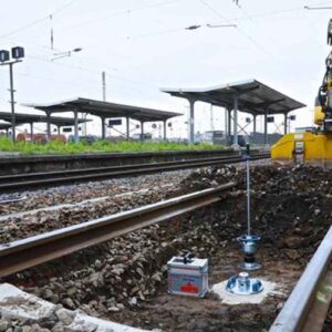
The GeoGauge is the perfect companion instrument for density measuring devices such as nuclear gauges and the electrical density gauge. Density measuring devices can be used to ensure that proper compaction is achieved and the GeoGauge can be used to verify that the stiffness/ modulus values assumed in the design specifications of new or rehabilitated pavement structures are met. Compacting and monitoring pavement layers directly to design requirements of structural layer stiffness or material modulus in addition to percent compaction during the construction process establishes the means to effectively control structural uniformity, strength and deflection, as well as enabling the monitoring and control of the construction quality of various materials. This leads to better smoothness and longer lasting pavement surfaces at lower cost.
The GeoGauge works by applying a vibrating force at 25 specific frequencies, which produce small deflections in the material. The resulting displacement is measured by the GeoGauge and displayed as stiffness determined by the ratio of the force to deflection. The GeoGauge produces stress and strain levels common for pavement, bedding and foundation applications. In addition, Young’s and shear modulus can be determined from GeoGauge measurements if a Poisson’s ratio is assumed.This dynamic technology used by the GeoGauge simulates real in-use conditions. This factor allows the GeoGauge to directly measure in-place engineering properties during the construction process. The GeoGauge supports and directly links the in-place engineering properties of compacted materials with Mechanistic-Empirical Design for effective QC/QA. Successful control of compaction creates a quality functional structure with the desired engineering properties for the application and life intended.
Applications include subgrade, sub-base, base, monitoring the strength gain of lime, cement, flyash and polymer stabilized materials, monitoring the re-compaction of underground utility backfills to previous properties matching surrounding undisturbed materials, monitoring the compaction of asphalt and cold in-place recycling to peak properties to prevent wasted effort and damaging over-compaction.
Specifications
Features include:
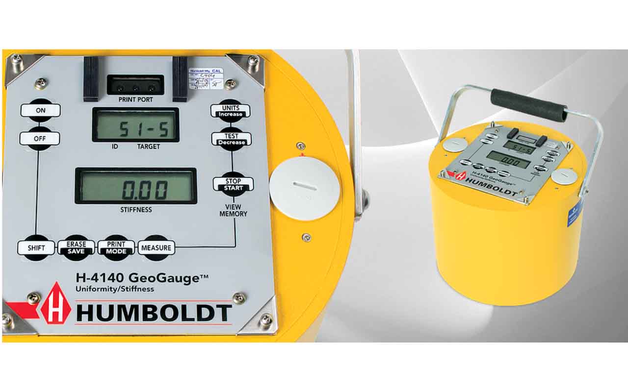
- Dynamically measures in-place engineering properties using structural layer stiffness, MN/m (klbf/in) and Young’s Modulus of a material, MPa (kpsi)
- In-place QC/QA links compaction and material performance directly to design requirements while advancing Mechanistic-Empirical Pavement Design
- Enables maximum lift stiffness with minimum compactive effort
- Facilitates uniform stress transmission and distribution from pavement to subgrade resulting in longer pavement life, reduced maintenance costs and longer lasting surface smoothness.
- Enables reduced structural variability in construction
- In-place QC/QA of the strength gain of stabilized materials
- Data base development supporting Mechanistic-Empirical Design and performance specifications
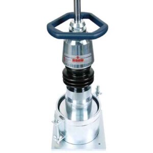
- Portable, fast, simple, reliable, non-invasive
- Other compaction applications include: lime, cement, fly-ash and polymer stabilized materials, cement-treated and rehabilitated bases, large particle aggregate bases, as well as underground utility backfills
- Gauge includes simple, easy-to-use software application, which provides download and storage of test data. Application allows printing of data reports, as well as saving information in other fornats (.pdf, .csv and Rich Text) for importing data into other programs